Charleston is a city synonymous with water. Its geography is defined by the movement of the tides, and its history and culture both stem from its proximity to and reliance on the sea. But, as flood risk increases, this enduring relationship faces new challenges.
Charleston’s Water Plan responds with a clear vision: embracing water not as an adversary, but as a guide for adaptation, stewardship, and long-term resilience.
Developed to provide a strategy to manage flood risks for 2050 predicted water levels, the Water Plan builds upon foundational efforts like Dutch Dialogues® Charleston and the 2021 City Plan. It brings together scientific modeling, citywide infrastructure strategy, and community-informed principles to forge a path forward, one that anticipates and addresses potential flooding from all directions: tides, sea levels, stormwater, storm surge, and groundwater.
Rather than proposing a single, top-down solution, the Water Plan is composed of a variety of citywide strategies and neighborhood-specific actions across scales, all defined by the city’s historic creek basins and urban watersheds.
Moffatt & Nichol's design studio Waggonner & Ball, leaders of Dutch Dialogues Charleston, is leading overall Water Plan development and urban design, while Moffatt & Nichol is leading coastal risk mitigation and engineering.
Charleston’s Water Future
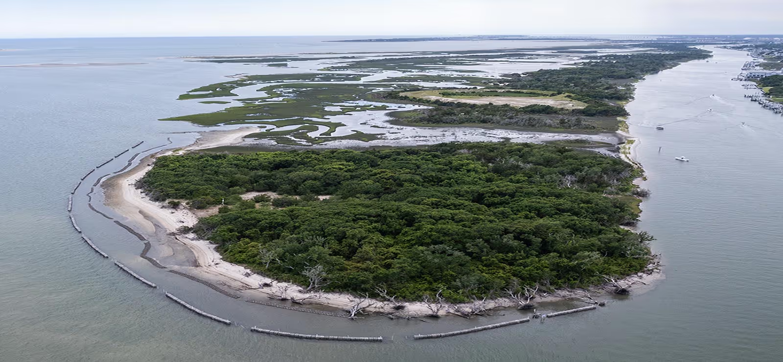
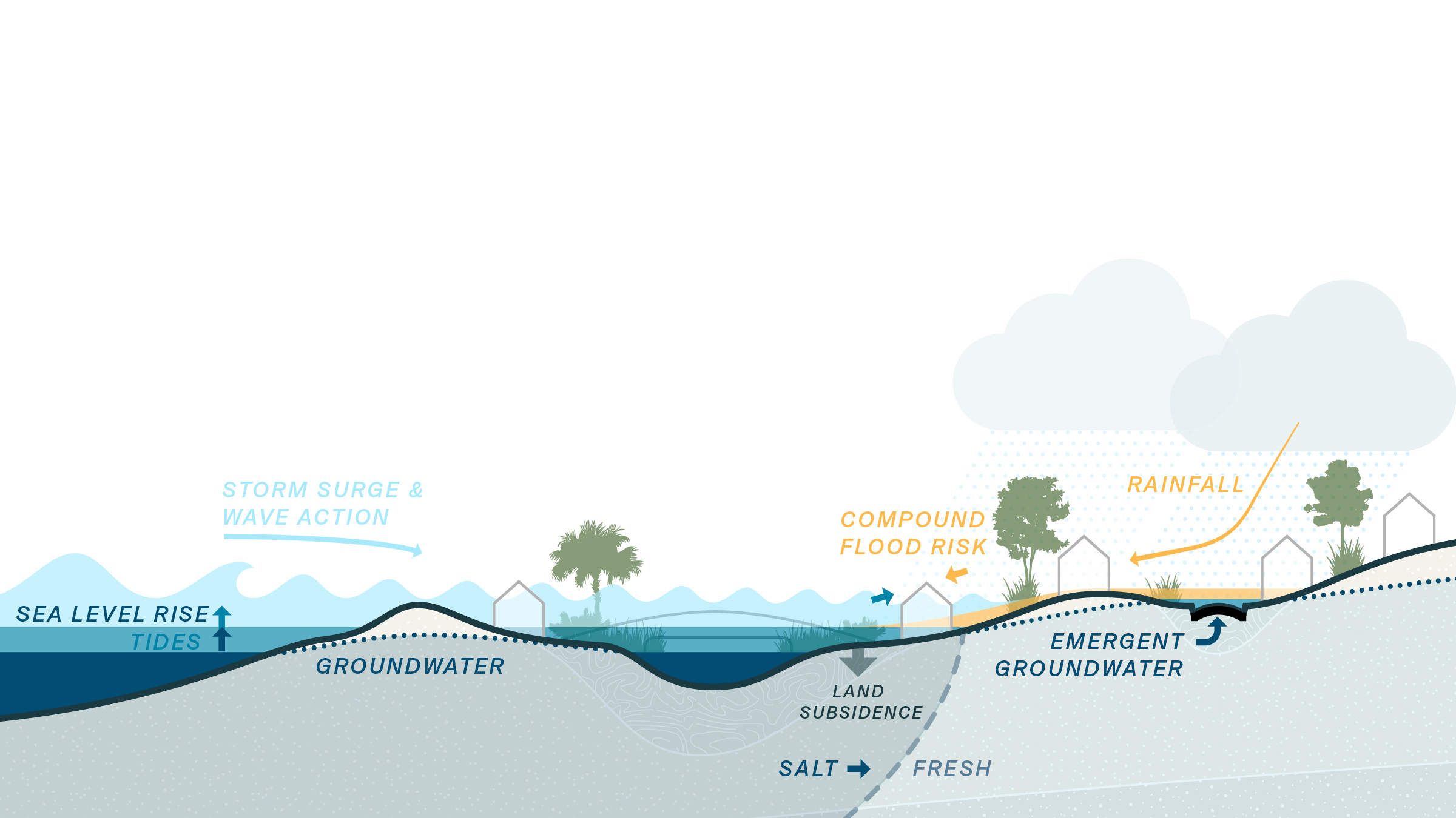
Charleston is ringed by creeks, rivers, and marshes that are supported by the changing tides. These same low-lying areas are at increased risk from compound flooding. As tidal flood risk grows in the future, the impact of routine rainfall becomes amplified, stormwater capacity is surpassed, and storm surges press further inland.
The Water Plan identifies that flooding is manageable, but doing so requires special attention as to how and where the city grows, prioritizing high ground for future development and investment and connecting lowlands with nature-based infrastructure that is designed to manage the flow of water.
The guiding principles of the Charleston Water Plan are:
- Elevation matters: value high ground and raise structures.
- Make Space for Water: connect low ground where water wants to be.
- Act now, adapt overtime: benefits must justify costs, but costs come before benefits.
In conventional urban areas, rainwater flows quickly across hard surfaces into drains and sewers. But when these systems reach capacity there’s often nowhere for the water to go. In coastal urban areas like Charleston, compound flooding occurs when rainfall coincides with high tides, overwhelming traditional drainage systems because they cannot discharge water into already-elevated coastal waters. As the water backs up, it can quickly flood roadways and communities. But what if existing outdoor spaces could help mitigate much of this flood risk? The solution lies in rethinking the way water flows around the city, and using a combination of natural and engineered systems to address these compound flood risks.
Citywide Strategies for Resilience
The Charleston Water Plan outlines several coordinated, citywide actions that position Charleston for long-term resilience. These include:
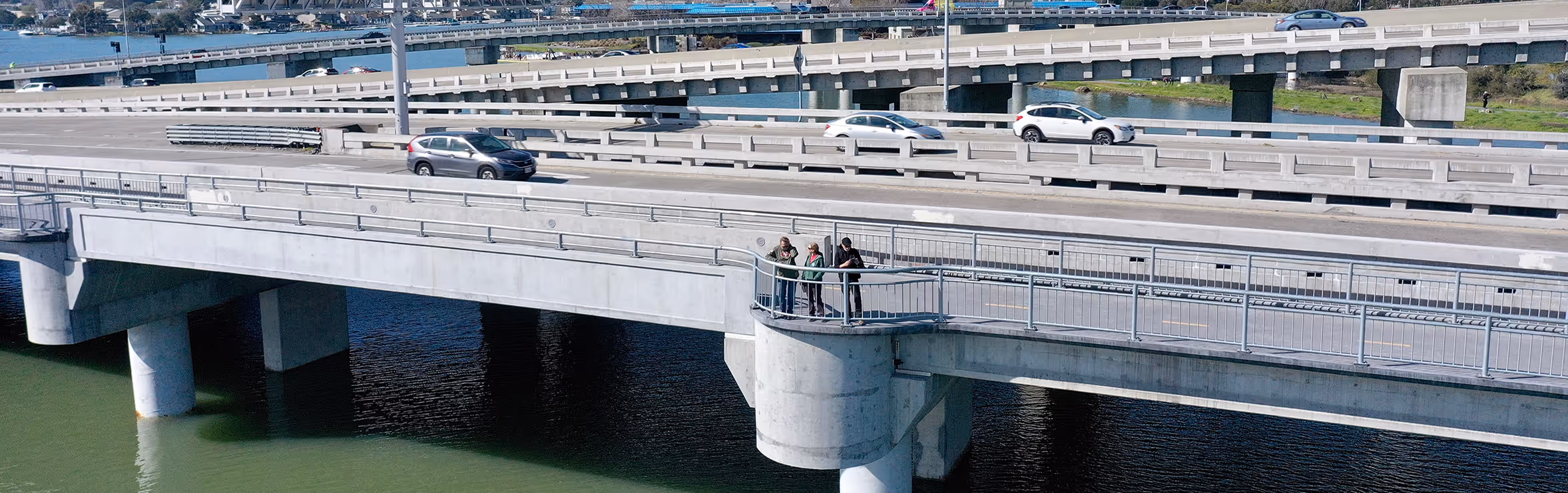
Protect and Connect: Enhance infrastructure corridors to improve utility and transportation resilience. The plan addresses flood risk by elevating key roads and intersections while integrating natural water storage systems alongside them. These channels help hold and filter stormwater, slowing its entry into the drainage. Together, these strategies help keep roads usable during storms and reduce pressure on surrounding infrastructure.
Build with Nature: Amplify the protection and maintenance of Charleston’s natural infrastructure. While wetlands, marshes, tidal creeks, and urban green spaces are an iconic part of Charleston’s landscape, they also play a critical role in managing flood risk. These systems naturally hold and absorb stormwater, helping to slow the flow of water into the city’s drainage system. Their permeable soils, dense root systems, and expansive surface areas reduce runoff, ease pressure on storm drains, and give floodwater a place to go. The plan prioritizes nature-based approaches by incentivizing projects that conserve, restore, and manage these ecosystems.
Invest and Adjust: Immediately develop comprehensive stormwater drainage models for all city hydrologic basins. Complete an inventory of the City’s drainage infrastructure, key features, and operations conditions, including coordination with surrounding and interconnected jurisdictions.
Through this a city-wide adaptive management program is developed for relevant city programs and departments impacted by changing water levels and related environmental thresholds. It prioritizes the needs of historically underserved communities through cost-benefit analyses to address long-term environmental justice concerns.
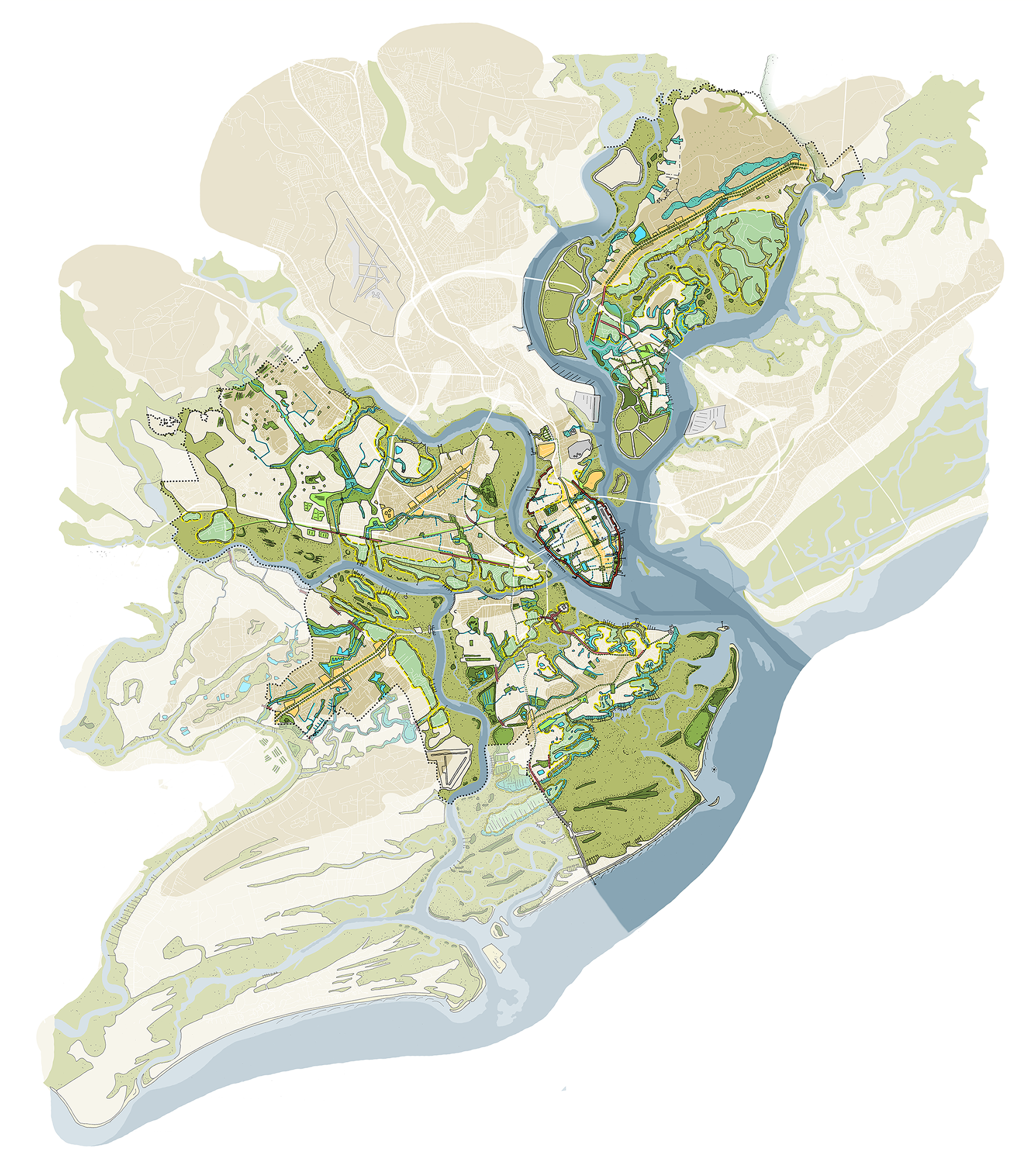
Tailored Solutions for Charleston’s Diverse Landscape
While Charleston shares a common challenge, its individual neighborhoods face unique flood risk profiles based on regional characteristics and existing infrastructure. The Water Plan responds to this complexity by pairing advanced flood modeling with industry expert insights to tailor solutions that meet each area’s specific needs.
For example, in West Ashley, the plan supports improvements like raising key roads and targeting higher ground for future development, such as the Sam Rittenberg corridor, while helping low-ground neighborhoods adapt to the growing influence of rising water.
On James Island, the central running James Island Creek is expected to rise and connect increasingly to the Stono River, forming James Island into two distinct land masses. Strategies for the area focus on managing growth atop these ridges and reinforcing major roads like Folly Road to safeguard access to the coast.
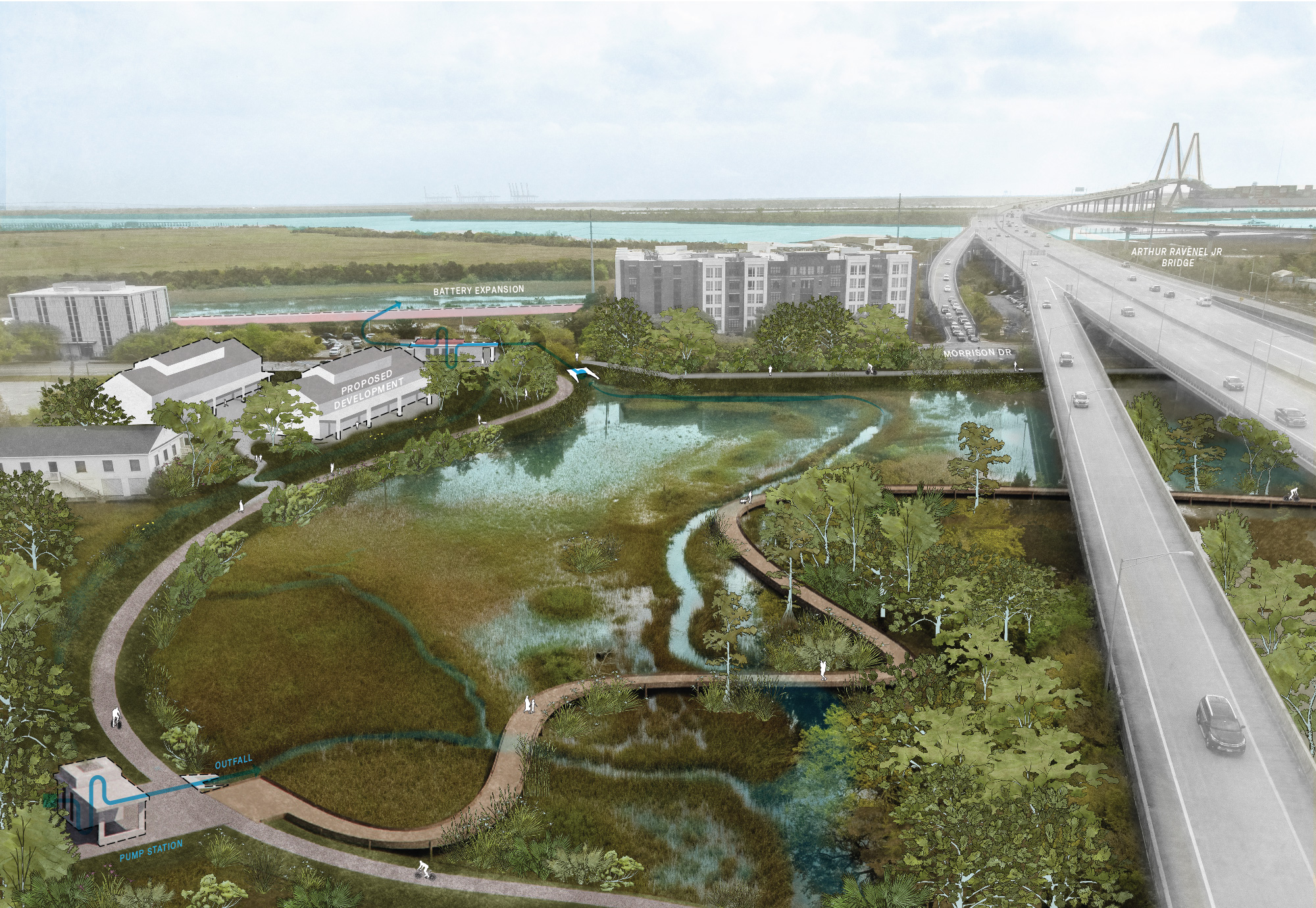
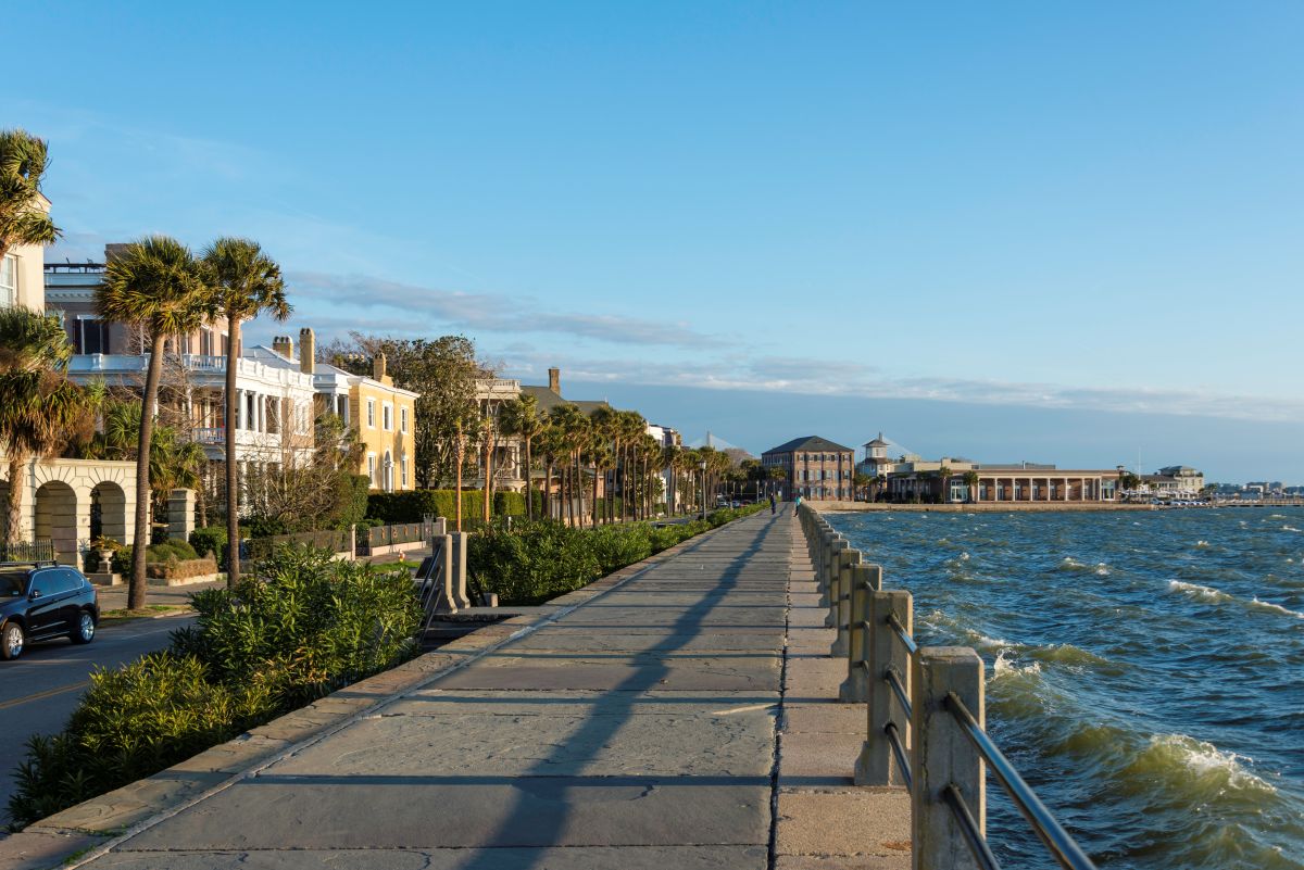
The historic Peninsula, which already faces multiple forms of flooding, requires a layered defense. This includes the Battery Extension project at the perimeter, upgraded pump stations, passive water storage, the long-term maintenance of tide gates within a raised edge system, and integration with the city’s recreation, transportation, and redevelopment priorities.
Across all neighborhoods of Charleston, the Plan aims to balance resilience with a distinct respect for history, ensuring that the city’s future is shaped in a safe and culturally attentive way.
Charleston and Water, Together
Moffatt & Nichol and Waggonner & Ball bring a distinct and thoughtful approach towards helping Charleston adapt. One of our main approaches, Living with Water®, focuses on the idea that tackling the challenge of resilience is not in trying to fight water, but instead learning how to live alongside it.
The work in Charleston is rooted in the belief that successful, lasting resilience does not only involve technical solutions but includes a new way of thinking about water in an urban landscape. That’s why Waggonner & Ball was invited to lead Dutch Dialogues® Charleston: a design-driven, collaborative workshop process that reimagined how the city could align its infrastructure, landscapes, and communities with the realities of increased flood risk.
The team brought together experts, local leaders, and community voices to explore how Charleston’s cultural history and natural systems could work together to inform a smarter, more adaptive future for the city, grounded in local values and priorities.
The benefit of this approach is clear: when community interests are central to planning, and decision-makers are part of the conversation from the beginning, early consensus and momentum carry forward to see ideas through to built completion. Charleston’s adoption of these principles is helping the city take steps toward a future that is not only safer and more resilient, but also more connected to its landscape and history.
More than just a flood management tool, the Charleston Water Plan is both a call to action and a framework for resilient transformation that will honor Charleston’s past while preparing for its future.
Throughout the plan, the concept of resilience is not merely about withstanding future challenges, it’s about investing in a version of Charleston that’s prepared for the future. One where communities have safe access to water, where nature plays a central role in city life, and today’s planning will preserve the city’s rich history for future generations.
Moving Forward
As multiple facets of the Water Plan move forward, a critical next step is the Battery Extension Project in partnership with the US Army Corps of Engineers. This will extend the existing historic Batteries around the full perimeter of the peninsula as a continuous park and promenade that doubles as storm surge and tidal flood protection. The next step toward implementation is set to begin this year as the Water Plan team works with the city to confirm the structure’s phasing and alignment and begin 15% design and engineering.